


🌍 Introduction
How Satellite Helps To surveillance Border?? Ever wondered how countries keep a close eye on their borders without constantly sending troops to patrol every inch? Enter satellite surveillance—a game-changer in modern warfare and intelligence. As the world watched India and Pakistan teeter on the edge of war in 2025, satellites silently orbited above, acting as invisible guardians and witnesses to every move.
🚀 What Is Satellite Surveillance?

Satellite surveillance is the practice of using space-borne satellites to monitor land, air, and sea activity. Initially developed during the Cold War, these orbital eyes have evolved drastically in terms of precision and capability.
There are several types of satellites used for surveillance:
-
Optical Imaging Satellites – capturing high-res pictures.
-
Radar Imaging Satellites – seeing through clouds and darkness.
-
Infrared Satellites – detecting heat signatures from vehicles and personnel.
📍 The Strategic Importance of Border Surveillance

Borders are more than just lines on a map—they’re flashpoints of potential chaos, especially in conflict-ridden areas like the Indo-Pak border.
Why is surveillance critical?
-
To detect infiltrations and prevent cross-border terrorism.
-
To monitor military buildup and movements.
-
To ensure national security without violating sovereignty.
🕵️ Traditional vs Modern Surveillance
Back in the day, border surveillance relied on soldiers, watchtowers, and binoculars. While still essential, that system left too many blind spots.
Modern surveillance, powered by satellites, gives a birds-eye view of massive stretches of land, day and night, rain or shine. It’s like upgrading from dial-up to fiber optics.
🇮🇳🇵🇰 India and Pakistan: A History of Conflict

India and Pakistan have had a rocky relationship since 1947. Multiple wars, skirmishes, and constant tension define this nuclear-armed rivalry.
Key moments:
-
1947, 1965, 1971 – Full-scale wars.
-
1999 – Kargil conflict.
-
Ongoing tensions along the Line of Control (LOC) in Kashmir.
In 2025, another standoff brought them to the edge again—and satellites were watching.
⚔️ The LOC – A Flashpoint
The Line of Control is more than just a border; it’s a live-wire zone. Soldiers on both sides face each other every day with rifles ready and nerves tight.
Constant attempts of:
-
Infiltration by militants.
-
Artillery shelling.
-
Drone intrusions.
Here, satellites serve as silent watchers, observing troop movements and alerting commanders of potential threats before they unfold.
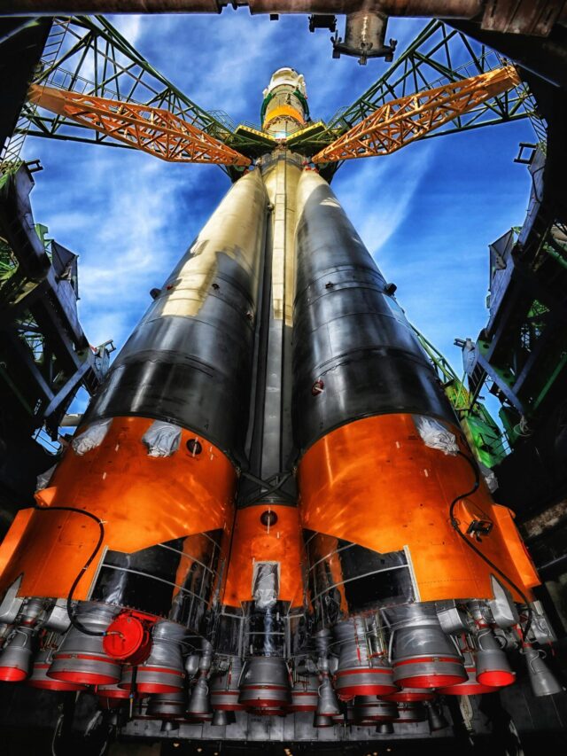
🛰️ How Satellites Are Used for Border Surveillance

So, how exactly do these space gadgets help during tense border times like 2025?
Real-Time Imaging
Modern satellites offer live imaging with 30cm or better resolution, allowing analysts to see even parked tanks or camouflaged bunkers.
Radar and Infrared Capabilities
With Synthetic Aperture Radar (SAR), satellites penetrate cloud cover and darkness. Infrared tech helps detect heat signatures from vehicles and personnel hiding in forests or caves.
Night Vision and Thermal Mapping
No sunlight? No problem. Satellites can still map activity through thermal differences—even underground tunnels are detectable.
🌐 Role of GEO, MEO, and LEO Satellites
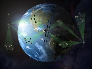
Each satellite orbit plays a unique role:
-
LEO (Low Earth Orbit): Best for high-resolution imaging and fast revisits. Used for tactical surveillance.
-
MEO (Medium Earth Orbit): Often used for GPS and timing.
-
GEO (Geostationary Orbit): Hovers over one area for constant surveillance.
India uses a combination of all three for round-the-clock coverage.
📡 Live Data Transmission to Ground Stations
What’s the point of data if it takes hours to get it?
Modern satellites beam images in real time to military command centers. Think of it like live-streaming a cricket match—but with tanks and radar trucks.
This helps in:
-
Quick deployment of troops.
-
Targeted airstrikes.
-
Predicting enemy intentions.
🇮🇳 India’s Satellite Capabilities in 2025
India’s ISRO isn’t just about space exploration—it plays a massive role in national defense.
Key military-grade satellites:
-
Cartosat series – optical earth observation.
-
RISAT series – radar imaging satellites.
-
GSAT-7A – for air force connectivity.
In 2025, these satellites were critical in tracking Pakistani troop mobilization and preventing surprise attacks.
🪖 Space-Based Surveillance During War
When conflict escalates, satellites become the first informers.
In the 2025 standoff, Indian satellites detected unusual troop movement across the LOC, prompting quick deployment of surveillance drones and increased patrols. This prevented a potential infiltration.
Satellites also helped in identifying terror launchpads across the border, enabling precise targeting without ground troop entry.
🛡️ How Pakistan Counters Satellite Surveillance
Pakistan isn’t sitting ducks either. They’ve adopted countermeasures like:
-
Camouflage nets to hide artillery.
-
Decoy installations to mislead surveillance.
-
Signal jamming to disrupt satellite communications.
They also rely on China for advanced satellite intel.
READ MORE:Newly discovered GI 410 b
⛅ Limitations of Satellite Surveillance
Nothing’s perfect, not even space tech.
Challenges include:
-
Cloud cover blocking optical images.
-
Time delays in satellite passovers.
-
Coverage gaps when satellites move out of range.
That’s why integration with drones and on-ground intel is vital.
🤖 The Role of AI in Satellite Surveillance

AI is the new commander-in-chief when it comes to surveillance analysis.
Benefits:
-
Detecting patterns in enemy movement.
-
Flagging suspicious activity automatically.
-
Predicting attacks before they happen.
It turns petabytes of satellite data into actionable intelligence in minutes.
🔭 The Future of Satellite Surveillance in Border Security
We’re moving into an era of next-gen surveillance:
-
Hyperspectral Imaging: detecting even hidden explosives.
-
Mini-satellite constellations: providing 24/7 real-time feed.
-
Satellite-drone hybrids: blending the flexibility of drones with satellite coverage.
The sky is no longer the limit—space is now a battlefield of data.
📝 Conclusion
As the India-Pakistan war scare of 2025 showed, satellite surveillance has become the backbone of modern border security. It’s like having a pair of super-eyes in the sky that never blink.
From detecting threats in advance to providing real-time battlefield visuals, satellites are reshaping how wars are fought—not just with bullets, but with bytes and beams.
❓FAQs
Q1. Can satellites actually prevent war?
Satellites can’t stop a bullet, but they can spot it before it’s fired—giving leaders time to respond and possibly de-escalate tensions.
Q2. How accurate are surveillance satellites?
Modern satellites can see objects as small as 30 centimeters—good enough to spot a rifle or even a human.
Q3. Do Pakistan and India both use satellite surveillance?
Yes, both countries use satellites, although India’s space tech (via ISRO) is more advanced. Pakistan often relies on China for satellite support.
Q4. Are satellites used only during war?
Not at all. They’re used round the clock, even during peacetime, to monitor borders, detect infiltration, and gather intelligence.
Q5. Can satellites be hacked or shot down?
Yes, anti-satellite weapons (ASAT) exist, and cyber attacks are possible, which is why securing satellite infrastructure is a priority.
Please don’t forget to leave a review.

Pingback: Age of Earth Water? | Older Than Sun | 2025 - astrobites